
Construction Organization Plan
A Construction Organization Plan (POS) brings the site layout, temporary facilities, traffic, utilities and safety measures into a coordinated construction scenario.
Concept diagram · not to scaleSite boundary / traffic route / lifting zone
What is a POS?
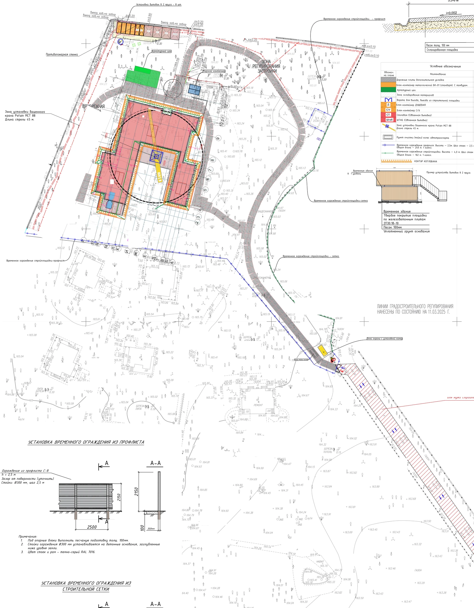
Its central drawing is the construction site plan. It coordinates the permanent building with temporary roads, facilities, cranes, hazard zones and utility routes so that the team can organise the site before work begins.
Site boundaries and facilities
Boundaries and fencing
The site plan records the work-zone boundary, fence type and height, post construction, support spacing and safe pedestrian routes.
Temporary site facilities
It locates temporary cabins, the canteen and site office together with their dimensions, areas and utility connections.
Movement and lifting operations
Cranes and hazard zones
It defines the crane position, working radius, outrigger footprint and the boundaries of lifting and falling-load hazard zones.
Roads and movement
It sets internal-road widths, turning radii, gates, traffic direction and the wheel-wash point at the exit.

Infrastructure and storage
Storage and work areas
It assigns material storage, a concrete-pump standing area with mixer positions and a segregated temporary waste area.
Temporary utilities
It maps electrical intake points, distribution boards, temporary water and drainage routes, sanitary facilities and site lighting.

Temporary works and safety
Road slabs and excavation
It defines temporary-road slab zones and quantities, the excavation boundary, protection system, warning barriers and signs.
Safety and key quantities
It records hydrants and fire points together with building footprint, temporary-building area and total temporary-road length.

Anonymised working fragments: identifying details and source metadata have been removed. Only flattened web images are published.
Before issuing the plan
- Coordinate site boundaries and fencing
- Check traffic routes and turning radii
- Define cranes and hazard zones
- Route temporary utilities and lighting
- Assign storage, waste and concrete-pump areas
- Record fire-safety points and temporary-work quantities